Nowadays there is plenty of user-friendly GIS applications and software, and we are here to help you chose the 7 easiest free GIS software. In short, GIS (geographic information system) are computer-based systems that enable manipulation with (geo)spatial information.
There are many useful tools for obtaining many different results using GIS software, such as analyzing, visualization, collecting and interpreting geographical data, seeking spatiotemporal patterns, and producing maps. They can be used by engineers, scientists, or enthusiasts dealing with spatial information. According to problems, needs, interests and targeted users, many specialized GIS software have been developed lately.

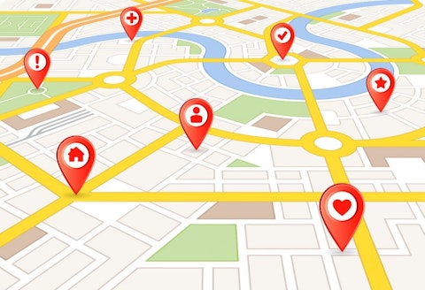
Copyright: pingebat / 123RF Stock Photo
GIS software are dealing with the input data such as coordinates, digitized maps, vector data (lines, points, areas), digital elevation models, etc. Then the fun part starts, the processing and creating new data with options available in the software. In a GIS software there are plenty of tools for analyzing and managing the data. It includes map layering and editing, predictive modeling, digitization, calculations, data visualization and many more. Apart from the spatial information, qualitative data can also be added, such as vegetational structure of an area, pollution level, population level or transportation density. Combining all of those features the final results can end up being simple and/or interactive maps (simple hiking maps or maps showing sights or features of an area), prediction models (like climate change prediction or archaeological prediction modelling), risk models (for example flood risks or pollution models) and many more. Apart from creating those maps, many information can be obtained using the input data: terrain slope, contour elevations, values of different environmental data, proximity, and density of certain features, etc.
For the insight in easiest free GIS software, we have gone through the suggestions from GISgeography, geocommunity, GISCRPS and GIS software comparison proposed by Virginia Geospatial Extension Program. Even though many GIS software do not require some special foreknowledge, a certain amount of time is needed to get used to any GIS software interface, algorithmic sequences and tool arangement.
Although free software are often seen as substitutes for non-open source software, as can be seen in 20 Popular Open Source Alternatives to Expensive Software, it certainly is not the case with some GIS software. If you’re not convinced, try some of the easiest free GIS software that we’ve listed here.
7. uDig
Supported OS: Windows, Linux, Mac OS 10
uDig can be used as simple stand-alone application which makes it one of the easiest free GIS software, but things can get complicated if you wish by extending this version with plug-ins available. As the name suggests, this software tends to be user-friendly, Desktop oriented, Internet oriented and GIS ready. The limitations of this software are the lack of tool abundance.

SFIO CRACHO/Shutterstock.com
6. Diva GIS
Supported OS: Windows
This is one of the specialized GIS software, oriented mostly towards biodiversity data and analysis. Some free data can also be downloaded that is compatible with many other GIS software. Apart from many tools included, the data export file formats are numerous and also compatible with other GIS software.

5. GRASS GIS
Supported OS: Windows, Mac OS 10, Linux
GRASS (Geographic Resources Analysis Support System) GIS is widely used software in government organizations such as NASA, because the abundance of tools that offer spatio-temporal data managing, image processing, visualization… It is free and since many people work on it, it is constantly being upgraded and tools are being added and improved. There are around 350 tools for creating and storing managing spatial data, dealing with both vector and raster data, rendering maps, digitizing, calculating, etc.
4. Saga
Supported OS: Windows 2000 and newer, Linux, Free BSD
Saga (System for Automated Geoscientific Analyses), the next on our list of easiest free GIS software is one of the user-friendly open source GIS software that offers a wide range of spatial manipulation tools, with user-friendly interface and many visualization options. It is widely being used by geoscientists and is suitable for fast and accurate terrain analysis.
3. MapWindow
Supported OS: Windows 98, ME, 2000, XP, 2003
Since 2004 this software became an open source one. It is suitable for both experts and beginners for GIS users. It is compatible with many usual file formats and enables exporting the same. Apart from the abundance of tools, handling with and manipulating the data is much easier than in some other GIS software, being done with just one click, which makes it one of the easiest free gis software. Updates and plug-ins are constantly being added.
2. gvSIG
Supported OS: Windows, Mac OS 10.4, 10.5, Ubuntu 6.x, Suse 8.2
Not only that gvSig is free open source Desktop software, it is also available for Mobile devices. It is user-friendly and offers a direct access to a great number of raster, vector, database query tools, easy geoprocessing, and also rendering time of big files is very fast. It is also available in many languages.
1. QGIS
Supported OS: Windows, Mac OS 10, Linux
Number one on our list of 7 easiest free GIS software is famous QGIS. It is one of most widely used cross platform open source GIS software that enables many options for managing geospatial data. Cross-platforming enables integration with other open source GIS software such as GRASS GIS, Map Server and Post GIS. It is constantly being improved with bugs being fixed and updates and new plug-ins released. It can be used in a variety of fields that concern spatial information thanks to the great number of tools and options.


